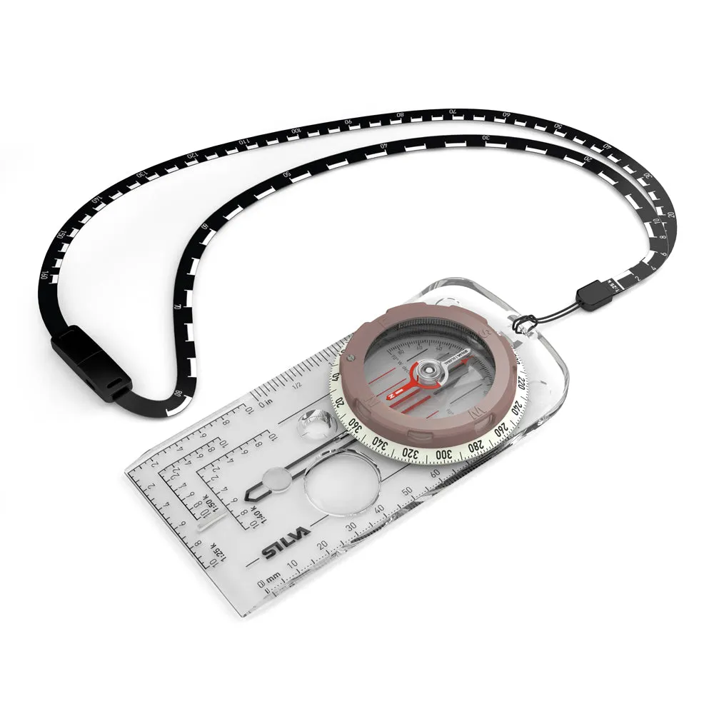
• SCALE LANYARD
- 2 scales, soft and bendable, easy to place directly on to your route on the map.
• SLOPE CARD
- Calculate avalanche risk, determine how challenging your journey will be
• WATERPROOF
- Withstands tough weather conditions
• BUILT IN MAGNIFIER
- For detailed map reading
• HOT STAMPED GRAPHICS
- Extra durable
• DRYFLEX™ RUBBER GRIP
- Easy handling of the compass/Great grip
• GLOBAL NEEDLE
- Can be used in all three magnetic zones
| Accuracy | 2° |
|---|---|
| Attachment | Detachable safety-release scale lanyard, Slope card |
| Clinometer | Yes |
| Declination adjustment | Yes |
| Graduation | 360° |
| Illumination | 4 hours after activation in light, Luminous markings |
| Included | Scale lanyard, slope card |
| Magnifying lens | Yes |
| Material | Acrylic, PC/ABS, TPU |
| Patented red/black N/S lines in capsule | Yes |
| Sapphire jewel bearing for friction-free movement of the compass needle | Yes |
| Scales | Base plate: 1:25k, 1:40k, 1:50k, mm, inch (1/20th), GPS scales |
| Sighting System | No |
| Silicon friction feet | Yes |
| Size | 60x127x13 mm |
| Type of compass | Baseplate, Global needle (MN, ME, MS) |
| Temperature operating range | -30 to 60 C |
| Turnable capsule | Yes |
| UTM position plotting scales (Romer scales) | 1:25k, 1:40k, 1:50k |
| Variant | Global (All zones: MN, ME, MS) |
| Weight | 52g |


 - 16-Unit Safe in Tan Leather")

![BG Triton2 Speed, Depth Wireless Wind System Pack - 2 Triton2 4.1" Color Display, DST810 Transducer, WS320 Wireless Wind Sensor NMEA2000 Starter Kit [000-14957-002]](https://www.watchglint.shop/image/bg-triton2-speed-depth-wireless-wind-system-pack-2-triton2-41quot-color-display-dst810-transducer-ws320-wireless-wind-sensor-nmea2000-starter-kit-000-14957-002_UpJJ1u_300x.webp "BG Triton2 Speed, Depth Wireless Wind System Pack - 2 Triton2 4.1\" Color Display, DST810 Transducer, WS320 Wireless Wind Sensor NMEA2000 Starter Kit [000-14957-002]")


![Garmin MSC 10 Marine Satellite Compass - Black [010-02407-10]](https://www.watchglint.shop/image/garmin-msc-10-marine-satellite-compass-black-010-02407-10_JUoNDq_300x.webp "Garmin MSC 10 Marine Satellite Compass - Black [010-02407-10]")
")
