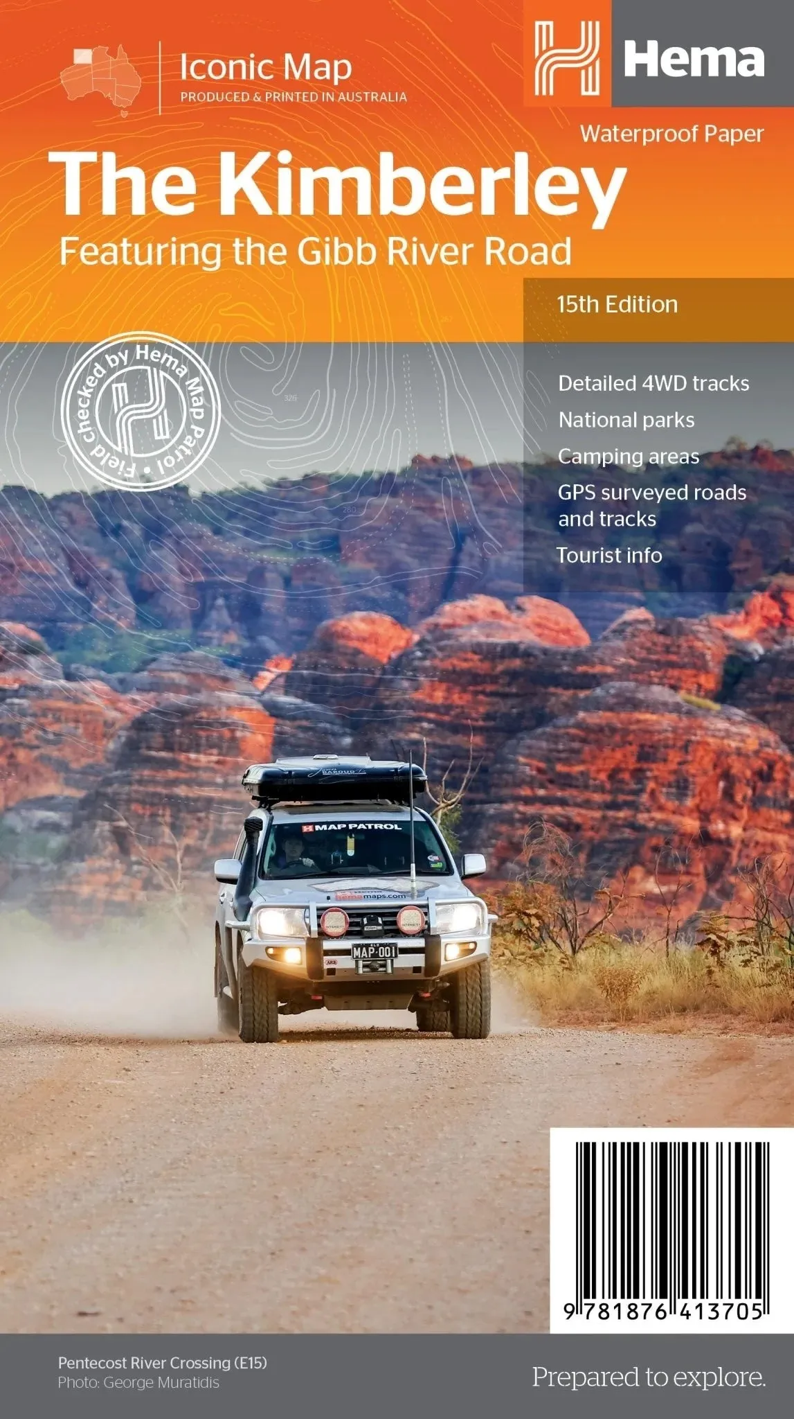
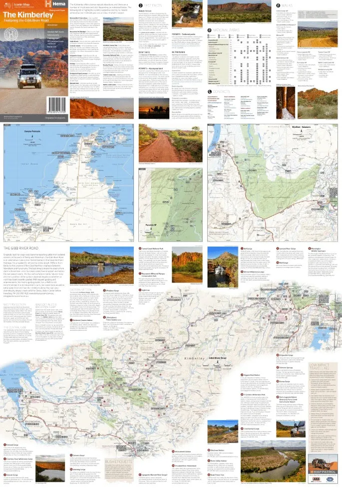
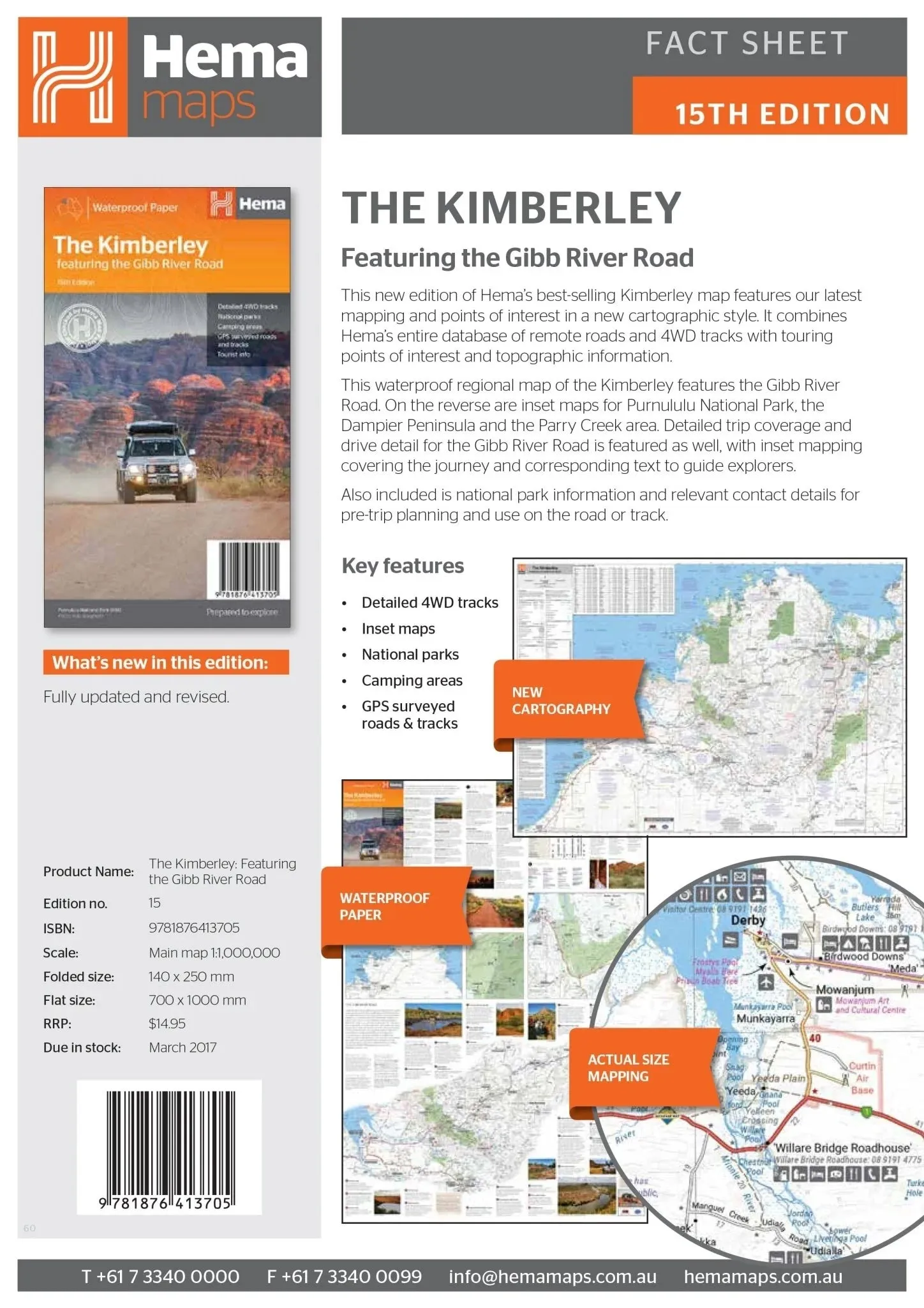
Kimberley Regional Map – 15th Edition
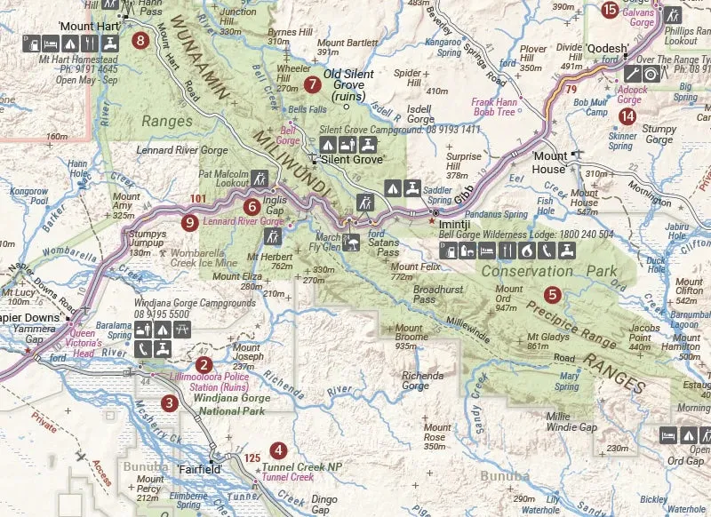
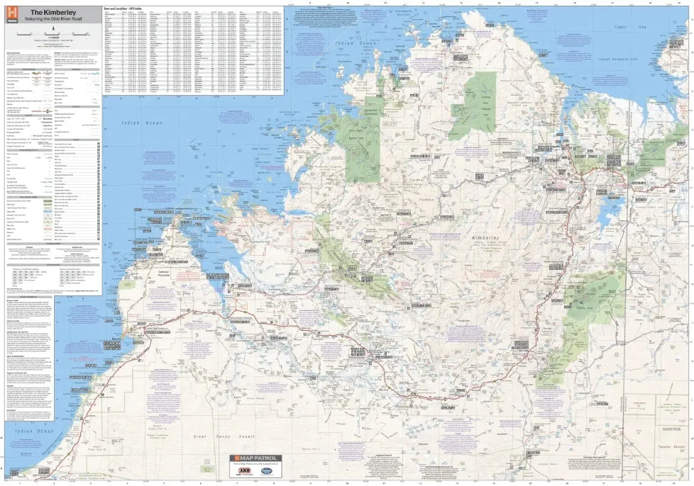
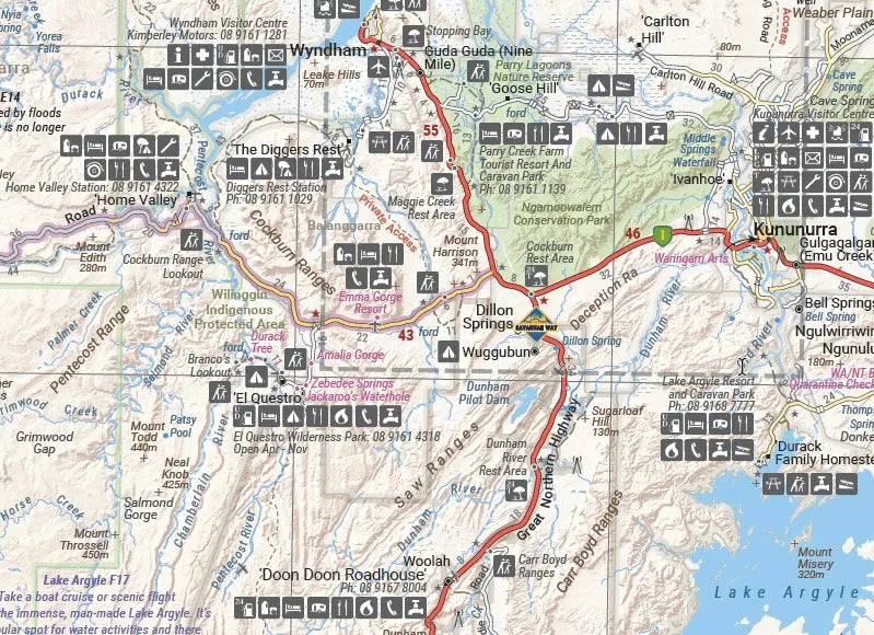
Discover the breathtaking Kimberley region with this detailed regional map featuring the iconic Gibb River Road. Printed on durable waterproof paper, this 15th edition map provides a comprehensive guide for adventurers exploring remote roads, national parks, and 4WD tracks. Inset maps of Purnululu National Park, the Dampier Peninsula, and the Parry Creek area offer enhanced detail for these iconic locations.
Features
- Durable waterproof paper for rugged use
- Detailed 4WD tracks and remote roads
- Comprehensive trip coverage and drive details for the Gibb River Road
- Inset maps for:
- Purnululu National Park
- Dampier Peninsula
- Parry Creek area
- Marked camping areas and national parks
- GPS-surveyed roads and tracks for precise navigation
- Touring points of interest and topographic information
Key Specifications
- Edition: 15th
- Publication Date: 01/03/17
- Scale: 1:1,100,000
- Folded Size (WxHxD): 140mm x 250mm x 3mm
- Flat Size (WxH): 700mm x 1000mm
- Weight: 0.09kgs
This map is the ultimate resource for exploring the Kimberley’s rugged landscapes, whether you’re embarking on the famous Gibb River Road journey or visiting national parks like Purnululu. With detailed inset maps, trip coverage, and essential pre-trip planning information, it’s an indispensable guide for travellers seeking adventure in this iconic Australian region.
About Hema Maps:
Hema Maps is a trusted name in cartography, providing high-quality and reliable maps designed for adventurers. Field-checked by the Hema Map Patrol, their products combine accuracy and durability, ensuring you have the best tools for your journey.


")


![Humminbird XPLORE 9 CMSI [412000-1]](https://www.watchglint.shop/image/humminbird-xplore-9-cmsi-412000-1_8nM34d_300x.webp "Humminbird XPLORE 9 CMSI [412000-1]")


